


The best hikes & walks in NSW
Emily Miller Beach, South Durras - Credit: Remy Brand/DPE

NSW is a treasure trove of hiking and walking gems. From easy strolls suitable for all ages to rugged, multi-day treks that can challenge even the most seasoned outdoorspeople – those looking to cover some ground won't be short of options.
Drawing hundreds of thousands of walkers a year, from local fitness gurus to out-of-towners eager to see what all the fuss is about, the Bondi to Coogee Coastal Walk is an institution in Sydney's Eastern Suburbs. Hugging the coast, you'll pass some of the city's most storied spots: pause for a game of bowls with a stunning seaside backdrop at Clovelly Bowls Club; pay your respects at Waverley Cemetery, one of the most scenic resting places in the world; and finish up at Coogee with a well-earned drink or bite to eat at the Coogee Bay Hotel. Extra points if you can plan your visit during the annual Sculpture by the Sea event, which sees artwork displayed around the section of the walk between Bondi and Tamarama.
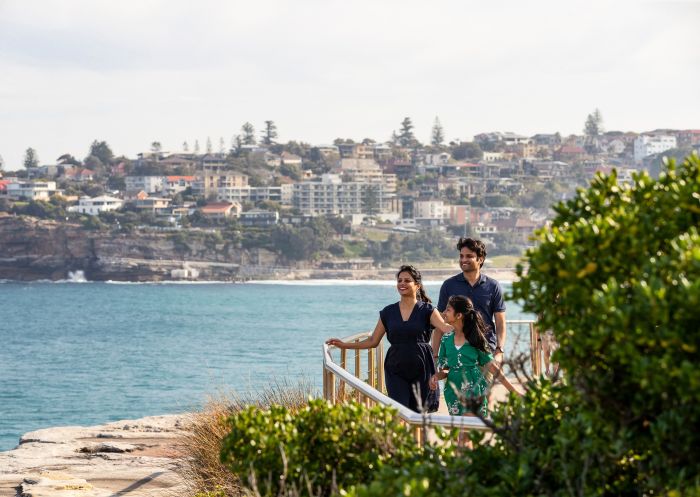
Bondi to Coogee Coastal Walk, Sydney
Newcastle’s beaches are some of the most glorious in the country and, lucky for Novocastrians, many of the beaches are connected on the Bathers Way Walk. In addition to stunning swimming spots along the way, you'll also be treated to wonderful views of the city and its most famous landmarks. In winter, when it might be a bit too chilly for a dip, keep your eyes peeled for whales playing at sea.
There are many spots to join the Bathers Way Walk, or you can start at either end. In the south, start at Merewether Ocean Baths, passing Merewether Beach, Dixon Park Beach, Bar Beach, Newcastle Memorial Walk, the Bogey Hole, Newcastle Beach, Newcastle Ocean Baths and Nobbys Beach before ending at the famous Nobbys Lighthouse. If you've still got some juice in your legs, continue out to the end of Nobbys Breakwall for an uninterrupted, 360-degree view of the sea.
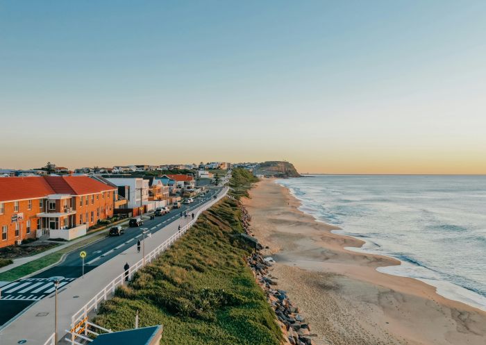
The Bathers Way, Newcastle - Credit: City of Newcastle
Popular with surfers, wellness enthusiasts and creative minds, thousands flock to Byron Bay for a taste of a slower-paced, bohemian life. The Walgun Cape Byron walking track offers the perfect snapshot of the area’s natural beauty, winding its way through the Walgun Cape Byron State Conservation Area.
You'll be treated to majestic coastal views (and potentially wallaby, whale, dolphin and stingray sightings) while dipping in and out of rainforest over this 3.7km loop. The path takes you right up to the Cape Byron Lighthouse, which has stood on watch at the most easterly point of Australia since 1901. The trail isn't too difficult or long, but does feature some moderately steep sections. Wander Byron offers guided sunrise walk experiences.
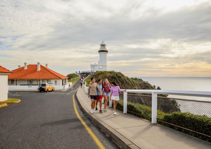
Cape Byron Lighthouse, Byron Bay
Out near Broken Hill sits Mutawintji National Park, and its arid, rocky landscape is primed for exploration. One excellent way to do so is on the Bynguano Range Walking Track, an offshoot of the Homestead Gorge walking track.
Experience the captivating natural terrain and unique environment of far western NSW and take in Aboriginal rock art, as well as kangaroos and emus among some of the rocky outcroppings that make up this incredible national park.
This Grade 5 walk is for serious hikers. Park at the Homestead Creek campground car park and start your journey there. On your way into the park, stop by the (unstaffed) visitor centre to get some key information and use the facilities before getting underway.
The Murramarang South Coast Walk traverses the Murramarang National Park and passes through coastal villages, secluded beaches and gum forests, starting at Pretty Beach south of Ulladulla and ending at Maloneys Beach north of Batemans Bay. You can choose to stay overnight in campsites or in cabins along the way, with several multi-day experience packages available through the NSW National Parks and Wildlife Service, including options for transfers and tours. Region X (which is eco-certified) and Women Want Adventure also offer guided experiences.
Keep an eye out for wildlife like lyrebirds, wonga pigeons, eastern grey kangaroos and more. From May to October is the best time to undertake this walk, and you may also spot whales as they migrate up and down the coast.
Murramarang National Park is also an area of rich Aboriginal cultural heritage. Just north of the start of the walk is Murramarang Aboriginal Area, which is one of the largest and most important Aboriginal sites on the NSW coast.

Murramarang South Coast Walk, Pretty Beach - Credit: Remy Brand | DPE
Hard work is rewarded on the Mount Kosciuszko Summit Walk. You'll be treated to views of some of the country’s tallest peaks, fields of wildflowers in spring and glacial lakes. While much of the hike is shared between walkers and bikers, cycling isn’t allowed on the final 1,400 metres to the summit of Mount Kosciuszko.
The walk is snowbound in winter, generally from June to October. While the route is open, it's best tackled on cross-country skis or snowshoes, and there are no snow poles marking the route.
The walk starts at Charlotte Pass inside Kosciuszko National Park. Guided experiences are available via Thredbo Guided Hikes and The Adventure Gene Pty Ltd.

Mount Kosciuszko Summit Walk, Kosciuszko National Park - Credit: Thredbo Resort
The Northern Beaches’ Spit Bridge to Manly Walk puts your feet on largely unfinished (but well-maintained) trails. You'll encounter gorgeous coastal views of Middle Harbour, coupled with a mix of bush and brushland, and Aboriginal rock engravings. The route is light on cafes and rest stops, so it’s a good idea to bring water and snacks, but make sure to save room for lunch in Manly. Head to Felons Brewing Co Manly for Mediterranean-leaning pub grub, craft beer and an ideal perch to watch the ferries come in.

Spit to Manly Walk, Manly
Beginning at Tomaree Head and weaving through pretty angophora forest, small coastal communities and past secluded beaches to the culturally significant Worimi Conservation Lands, the Tomaree Coastal Walk is a lesson in NSW beach beauty, and an ideal city getaway. The journey is best experienced as an overnight walk staying at nearby off-park accommodation such as Port Stephens Koala Sanctuary or Shoal Bay Holiday Park, however, it can also be completed in three days for a more leisurely pace.
Keen on a shorter, but equally beautiful experience? The Tomaree Head Summit Walk is 2.2km-return, Grade 5 hike overlooking the Jurassic Park-like Shoal, Port Stephens and Fingal bays, beginning at the end of Shoal Bay Road.

Tomaree Head Summit Walk, Port Stephens
Starting at Wentworth Falls and ending at Katoomba, the Grand Cliff Top Walk is an ideal way to see many of the highlights in the Blue Mountains National Park. Discover Aboriginal culture, spectacular lookouts, the Three Sisters, numerous waterfalls and quaint villages. Stay overnight in Leura to sample the excellent restaurants, pubs and boutiques.
Listen out for the yellow-tailed black cockatoo – named Wumbarrung in the Gundungurra language – the wayfinding symbol for this walk and a significant bird to the traditional custodians of Gundungurra Country.
Blue Mountains Adventure Company offers an eco-certified guided experience, if preferred. Blue Mountains Tracks and Retreats and Emu Trekkers also offer guided experiences.

Grand Cliff Top Walk, Wentworth Falls
Located in the Sapphire Coast’s Beowa National Park, the Light to Light Walk is a hidden gem, primed for wilderness adventure. Starting at historic Boyds Tower and finishing at the iconic Green Cape Lighthouse, walkers weave through an ever-changing landscape of red clifftops, sheltered coves, eucalypt forest and coastal heathland, spotting wildlife along the way, including seals, seabirds and seasonal migrating whales.
Experienced walkers can tackle the track carrying their own packs and supplies, and by booking a two-night self-guided camping experience. Transfer services are available to assist with transport to and from the track, as well as guided experiences by Navigate Expeditions, Sapphire Coast Guiding Co and Life’s an Adventure (all eco-certified); and Park Trek Walking Holidays.
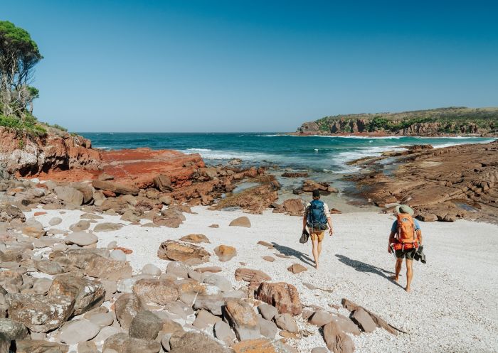
Light To Light Walk, Hegartys Bay - Credit: Remy Brand | DCCEEW
Journey across Australia’s alpine roof with the Snowies Alpine Walk in Kosciuszko National Park. The 56km, four-day hike will take you through unique alpine landscapes and up to the summit of Australia’s highest peak: Mount Kosciuszko. While you’re there, wander through wildflower meadows, snow gum forests and glacier-carved landscapes.
If you’d prefer a guided experience, there are many operators who facilitate group and private experiences: The Adventure Gene, Australian Walking Holidays, Thredbo Guided Hikes (sustainable certified), Life’s An Adventure (eco-certified) and Women Embrace Adventure.

Snowies Alpine Walk, Kosciuszko National Park - Credit: D Parsons | DCCEEW
The Gidjuum Gulganyi Walk is a multi-day adventure through the Tweed-Byron hinterland on Bundjalung Nation. Over 42km, traverse an ancient volcanic landscape and weave through Gondwanan rainforest set in Mount Jerusalem National Park, Whian Whian State Conservation Area and Nightcap National Park. Along your journey see stunning mountainous landscapes, volcanic calderas and plunging waterfalls, before setting up camp in secluded campsites.
Guided experiences are available via Connect Adventures and eco-certified Vision Walks Eco Tours.

Gidjuum Gulganyi Walk - Credit: D Parsons | DCCEEW
A challenging hike set against the World Heritage-listed Oxley Wild Rivers National Park, the Green Gully Track is an adventurous undertaking, ideal for experienced hikers. Across four days, hikers journey deep into the Apsley-Macleay gorges, one of the largest systems in Australia; across fern-lined gullies and through mountain streams with towering rocky outcrops along the way. One of the many benefits of this walk is that there are huts along the way, no tents needed. Guided experiences are available with Aussie Bike or Hike.
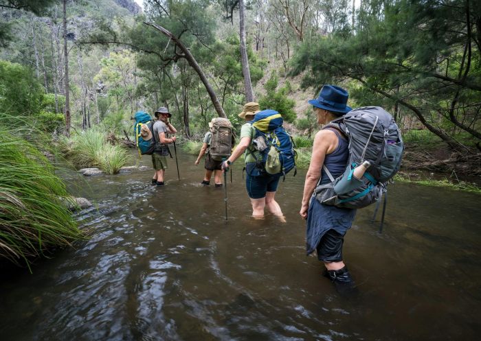
Green Gully Track, Yarrowitch - Credit: DCCEEW
Before planning or booking your trip, visit the NSW National Parks website to stay up to date on news, important information, alerts and closures, and to fill trip intention forms.
VisitNSW.com is the official tourism site for Destination NSW.
© Copyright 2026 Destination NSW. All rights reserved


