


Destination NSW

By Destination NSW

Share
Articles
11 of the best hikes in Byron Bay & surrounds
Protesters Falls, Nightcap National Park - Credit: Visit Lismore

You’ll find many easy walks along the amazing coastline around Byron Bay. For something more challenging, head west into the Byron Hinterland and its rich range of national parks waiting to be explored.

Walgun Cape Byron Walking Track

  • Distance: 3.7km loop
  • Suggested duration: 2 hours
  • Difficulty: Moderate / Grade 3
  • Distance from Byron Bay: 4km / 10-minute drive
  • Parking: Available at Captain Cook Lookout, The Pass, Wategos Beach and Cape Byron Lighthouse. Fees apply and it can get very busy.

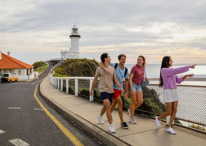
When you're talking about the best Byron Bay hikes and walks, no list is going to be complete without this signature stroll. The Walgun Cape Byron Walking Track has a little bit of everything. And while you can complete the 3.7-kilometre loop in a couple hours, why would you ever want to? As with most things in this part of the world, it's better to just leave the watch at home and take your time.

Spend the whole afternoon working your way slowly through the different sections of this walk. You'll have access to wonderful beaches and views of the ocean, walk on cliff tops and through beautiful rain forest, and get a chance to visit the storied Cape Byron Lighthouse. Tackle smaller sections of it with the kids, especially if you want to stop off at a couple of beaches, or break the journey with an organic juice at one of the cafes dotted along the route.
See map

Three Sisters Walking Track

  • Distance: 1.6km return
  • Suggested duration: 30-45 minutes
  • Difficulty: Easy /Grade 2
  • Distance from Byron Bay: 8.5km / 15-minute drive
  • Parking: A paved car park sits at Broken Head picnic area at the start of the track, but be aware it can fill up on weekends. There’s a park entry fee of $4 per vehicle per hour.

To the south of Byron Bay sits the delightful Broken Head Nature Reserve. The Three Sisters Walking Track is an easy, yet satisfying, way to explore this area. You'll walk among the trees in a pleasant rainforest setting before culminating with yet another fantastic view of the NSW coastline at the captivating Kings Beach. This is another walk that hits many of the spaces on any Byron hike BINGO card: lush bushland, bright flowers, information about native people and wildlife, huge views of the coastline and easy beach access.

While not a paved or boardwalked track, there's nothing too difficult here, making it another great option for walkers of just about all ages and abilities. Finding the trailhead is also quite easy, as you can take off straight from the Broken Head Nature Reserve car park.

See map

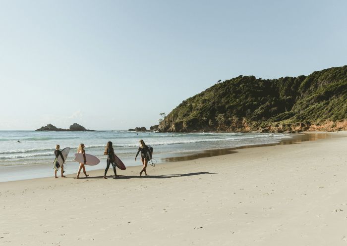
Surfers walking along Broken Head Beach in Byron Bay, North Coast

Broken Head Beach, Byron Bay

Lennox Head Boardwalk

  • Distance: 1.4km
  • Suggested duration: 30 minutes one way
  • Difficulty: Easy
  • Parking & distance from Byron Bay: 20km / 20-minute drive
  • Parking: Free parking is available at the end of Rutherford Street, where the boardwalk begins.

Sometimes less is more. Lennox Head is the next town south of Byron Bay and its waterfront boardwalk is an excellent short walk, especially for those with limited fitness or who have some youngsters with them. As with most walks in this region, you'll be treated to expansive views of the Pacific Ocean. But what makes this option so nice is that these views are paired with a finished, family-friendly boardwalk route and a welcoming town full of cafes, restaurants and all-important bathroom facilities. Grab a coffee as you head out or reward the kids at the end with a tasty treat.

Park at the end of Rutherford Street and start the walk there. You'll head south, with the ocean on your left, until you reach Pat Morton Lookout atop Lennox Point. As Lennox Head is a favourite surfing spot for locals, you'll have plenty of entertainment as you watch people paddle, ride and wipe out from your perch on 'The Point'.

See map

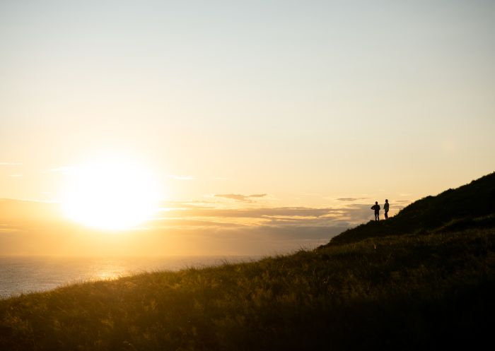
Friends walking across headland, Pat Morton Lookout, Lennox Head

Pat Morton Lookout, Lennox Head

Killen Falls

  • Distance: 330m return to the lookout or 1km return to the base of the falls
  • Suggested duration: 20-30 minutes to the lookout; allow closer to an hour for the full return trip to the base
  • Difficulty: Moderate, with some steep and slippery parts
  • Parking & distance from Byron Bay: 25km / 30-minute drive
  • Parking: Free parking is available at the reserve, along with a public toilet.

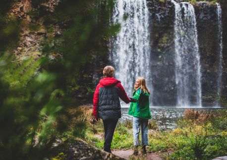
Killen Falls is one of the most photogenic waterfalls hidden in the Northern Rivers hinterland. Close to the village of Tintenbar, the falls sit within a pocket of the Big Scrub, the sub-tropical rainforest that once blanketed the region but now covers just one per cent of its original range.

From the car park, an easy walk winds through the greenery to a lookout with sweeping views down into the pool below. If you're up for it, a steeper (and sometimes slippery) track leads down to the base of the falls, where you can duck behind the cascade into a small cave and look out through the falling water – one of the best photo spots in the area. Keep an eye out for turtles and birdlife around the pool.

See map

Three friends enjoying the waterfalls, Killen Falls, Tintenbar

Killen Falls, Tintenbar

Minyon Falls Loop

  • Distance: 13km return
  • Suggested duration: 3-4 hours
  • Difficulty: Moderate / Grade 3
  • Distance from Byron Bay: 34km / 45-minute drive
  • Parking: Free car and bus parking is available at both the Minyon Falls and Minyon Grass picnic areas, though spaces can be limited on weekends and holidays.

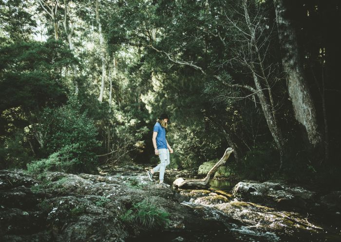
To the west of Byron Bay, in the lush Byron Hinterland, is the Minyon Loop Walk, leading you to one of NSW's best waterfalls. Minyon Falls plunges 100 metres through the World Heritage-listed rainforest of Nightcap National Park. It's a Grade 3 track, so there are challenging sections, but you'll be rewarded with gorgeous greenery at every turn. Pack picnic gear for a refuel at Minyon Grass picnic area or the scenic Minyon Falls lookout. Make sure to also pack your swimmers, as you can jump into the clear pool at the foot of the falls.
See map

Person standing below Minyon Falls, Minyon Falls, Nightcap National Park - Credit: Visit Lismore

Minyon Falls, Nightcap National Park - Credit: Visit Lismore

-

Unicorn Falls Walking Track

  • Distance: 4.2km return
  • Suggested duration: 1-2 hours
  • Difficulty: Moderate / Grade 3
  • Distance from Byron Bay: 40km / 50-minute drive (note that the final stretch is unsealed and 4WD is recommended in wet weather)
  • Parking: There is a free car park on Manns Road at the start of the track.

Deeper into the hinterland, in the Mount Jerusalem National Park, Unicorn Falls walking track is a peaceful bushwalk that rewards you with one of the region's prettiest waterfalls. Starting from the Manns Road carpark, the track winds through tall eucalypt forest before dropping into lush sub-tropical and temperate rainforest, crossing a couple of creeks along the way.

Unicorn Falls itself is a shaded, tranquil spot to stop, cool off and refill the water bottle. Keep your eyes peeled for some of the park's threatened residents, including Albert's lyrebird and the red-legged pademelon, plus eastern yellow robins flitting through the canopy. Summer is the best time to visit, when the falls are running at their fullest; in winter the flow can slow to a trickle and the forest canopy keeps things cool and dim.

See map

Unicorn Falls, The Tweed - Credit: Cape Productions | Tweed Tourism Group Australia

Unicorn Falls, The Tweed - Credit: Cape Productions | Tweed Tourism Group Australia

Gidjuum Gulganyi Walk

  • Distance: 42km one-way
  • Suggested duration: 4 days / 3 nights
  • Difficulty: Challenging / Grade 4 (bushwalking experience recommended)
  • Parking & distance from Byron Bay: 40km / 50-minute drive
  • Parking: As it's a one-way track, most walkers book a return shuttle transfer rather than leaving a car at either end.

If a day walk isn't enough, the Gidjuum Gulganyi Walk is the region's newest bucket-list hike – an epic 42-kilometre, four-day trek that links Mount Jerusalem National Park, Whian Whian State Conservation Area and Nightcap National Park along the rim of an ancient volcanic caldera. Gidjuum Gulganyi means 'Old People's Track' in Bundjalung language, honouring the Widjabul Wia-bal and Minjungbal People who have walked this Country for thousands of years.

The one-way route runs north to south, starting at the same Manns Road carpark as Unicorn Falls and finishing at the spectacular Minyon Falls lookout, taking in rainforest creek crossings, caldera lookouts and three walk-in campgrounds along the way. You can self-guide and carry your own gear, book a return shuttle transfer, or join a guided pack-free tour if you'd rather leave the logistics to someone else. Prefer to sample it in smaller bites? Sections of the track also work well as half-day or full-day walks.

See map

Gidjuum Gulganyi Walk - Credit: D Parsons | DCCEEW

Gidjuum Gulganyi Walk - Credit: D Parsons | DCCEEW

Victoria Park Boardwalk

  • Distance: 400m loop
  • Suggested duration: 30 minutes
  • Difficulty: Easy / Grade 1
  • Distance from Byron Bay: 50km (40-minute drive
  • Parking: Free parking is available in a car park on Victoria Road.

Another of the region's quick walks that's perfect for families, the Victoria Park Boardwalk is in a quiet nature reserve between Ballina and LismoreVictoria Park Nature Reserve represents some of the area's pre-colonial rainforest known as the Big Scrub which once covered 45,000 hectares. You'll find plenty of information dotting the walk about native bushland and the area's indigenous population. There are barbecues and picnic tables for public use if you want to recharge.

See map

Victoria Park Boardwalk, Ballina

Victoria Park Boardwalk, Ballina - Credit: Discover Ballina

Protesters Falls Walking Track

  • Distance: 1.4km return
  • Suggested duration: 1-1.5 hours
  • Difficulty: Moderate / Grade 3
  • Distance from Byron Bay: 70km / 75-minute drive (You’ll need to travel on an unsealed road and a causeway crossing on the way in can become boggy or impassable after rain, so check conditions before you set out)
  • Parking: Free parking is available at Terania Creek picnic area, though it can be busy on weekends.

West of Byron Bay, deep in Nightcap National Park near Lismore, Protesters Falls walking track leads through magnificent World Heritage-listed rainforest to one of the region's most storied waterfalls. Elevated boardwalk sections make this short walk an easy, family-friendly outing, and it's a lovely stop if you're doing a driving tour of the North Coast hinterland.

The track takes its name from the Terania Creek protests of the late 1970s, which helped save this pocket of pristine rainforest and became a landmark moment for the Australian conservation movement. Sculptural elements at the start of the walk tell the story before you head off beneath towering yellow carabeen and strangler figs, keeping an ear out for the rose-crowned fruit dove and barred cuckoo-shrike. When you reach the falls, take a moment to sit and soak it in – just remember swimming isn't permitted here, to protect habitat for the threatened Fleay's barred frog.

See map

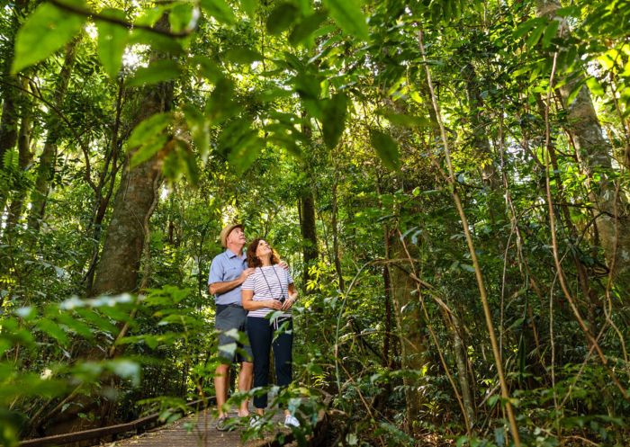
Canopy of trees in forest, Protesters Falls, Nightcap National Park - Credit: Lismore City Council

Protesters Falls, Nightcap National Park - Credit: Lismore City Council

Jerusalem Creek Walk

  • Distance: 10.3km loop
  • Suggested duration: 3-4 hours
  • Difficulty: Moderate / Grade 3
  • Distance from Byron Bay: 80km / 80-minute drive
  • Parking: Available at the Mibanbah – Black Rocks campground and Booroora picnic area. It’s free, but there is a park entry fee of $8 per vehicle per day.

If you're going to Byron, you're probably keen to spend some time in the water. The Jerusalem Creek Walk gives you a chance to do exactly that, but not in the way you might think. This trail, located in Bundjalung National Park, takes you through lush bushland before emptying you out where the titular creek meets the ocean.

This is a great option for birdwatching aficionados, with a range of shorebirds calling the area home. And if you've got the right gear, you can even paddle in the creek or have a swim. This hike is flat and well-maintained, so despite the length, it's not too difficult. If you want to complete the entire 10.30-kilometre loop, plan to spend the whole day away from Byron. The trail starts at the northern end of the Mibanbah – Black Rocks campground and it's signposted, so you can't miss it.

See map

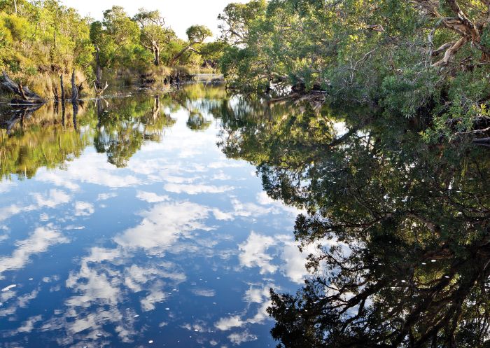
Jerusalem Creek, Bundjalung National Park

Jerusalem creek, Bundjalung National Park - Photo Credit: Rob Cleary

Pinnacle Walk

  • Distance: 600m return
  • Suggested duration: 30-45 minutes
  • Difficulty: Easy / Grade 2
  • Parking & distance from Byron Bay: 108km / 2-hour drive
  • Parking: A free gravel car park is available at the start of the walk. It is accessible for a standard car though a 4WD is recommended in wet weather. The park entry fee is $8 per vehicle per day.

For years, hikers on the North Coast flocked to the challenging nine-kilometre Wollumbin (Mount Warning) Summit Track. However, in 2015 the Bundjalung People asked visitors to respect this sacred native place and refrain from climbing it. The Pinnacle Walk is the perfect alternative, allowing you to respect their wishes while still getting a fantastic look of Border Ranges National Park. Just 600 metres return, the Pinnacle Walk to the Pinnacle Lookout will treat you to amazing views of Wollumbin while you gaze out over dense rainforest and the Tweed Valley.

If you decide to make the trek from Byron, you can check out other short hikes in Border Ranges National Park to make the most of your time, including the Border Loop WalkPalm Forest WalkBar Mountain Circuit and more.

See map

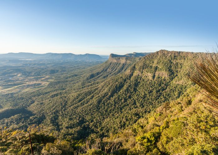
View from the Pinnacle Lookout across the Caldera to  Wollumbin Mount Warning

Pinnacle lookout, Coolah Tops National Park

FAQs

What are the best short walks under one hour around Byron?
Which Byron Bay walk has the best ocean views?
Where can I see whales while walking in Byron Bay?

Where can I see whales while walking in Byron Bay?

The cooler months (roughly May to November) bring the humpback migration past the coast, and many walks double as excellent whale-watching spots:

Are there rainforest walks near Byron Bay?

Are there rainforest walks near Byron Bay?

Head into the hinterland and you'll find some of the region's best pockets of subtropical and World Heritage-listed rainforest:

What hikes in Byron Bay are suitable for children or families?

What hikes in Byron Bay are suitable for children or families?

These walks are short and well-formed, making them a good match for little legs (always check current NPWS grading and conditions before you head out):

What's the best waterfall walk near Byron Bay?
Best walks to watch the sunrise in Byron Bay?
Are there any dog-friendly walks in Byron Bay?

Are there any dog-friendly walks in Byron Bay?

Most of Byron’s best walks sit within national parks or nature reserves, where pets aren't permitted (assistance animals excepted). One exception is Lennox Head Boardwalk – dogs are allowed on leash along the path, with an off-leash area on Seven Mile Beach further north. There are more off leash areas on Belongil Beach and Tallow Beach.